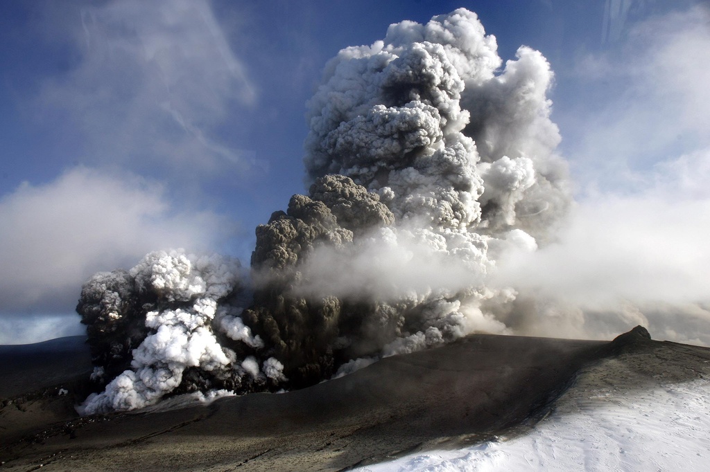
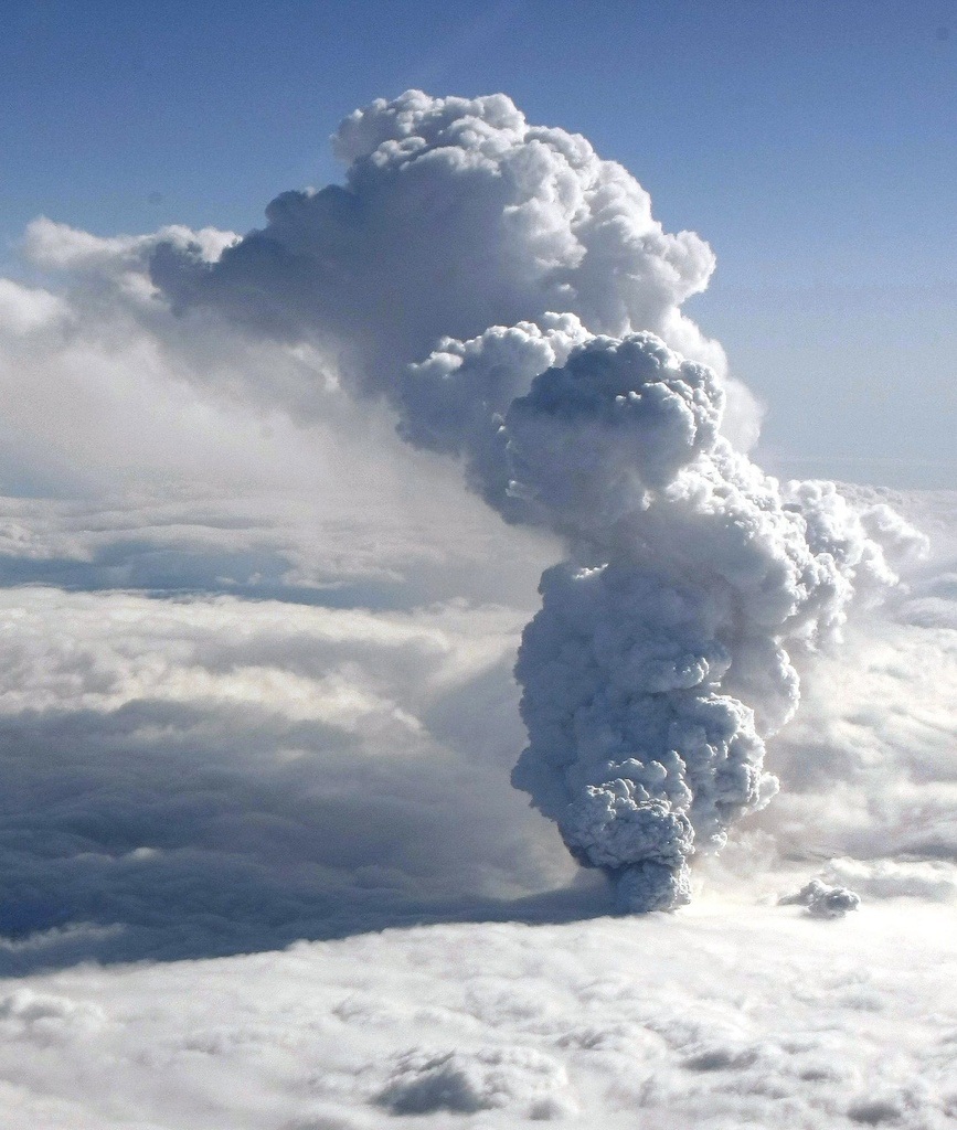
Swiss lasers map volcanic ash cloud
Laser weather technology, originally devised for 3D humidity maps, is the ideal solution for monitoring the volcanic ash cloud, says a top MeteoSwiss official.

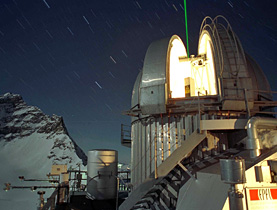
Bertrand Calpini and his team at the MeteoSwiss Aerological Station in Payerne have been using the innovative Light Detection and Ranging (Lidar) weather measurement system to map the ash cloud over Switzerland.
The Federal Civil Aviation Office said on Monday morning that the cloud, which arose following the eruption of a volcano in Iceland on April 14, remained over the country and another ash cloud was expected soon.
Large parts of Europe enforced no-fly rulings for a fifth day on Monday because of the cloud, causing the worst air travel chaos since the September 11 attacks.
The high-tech instrument, launched in 2008, provides continuous data on the vertical distribution of humidity in the atmosphere up to an altitude of 10km. It can also detect fine particles, including pollen, and can build up 3D temperature profiles.
swissinfo.ch: How is the Lidar system, originally devised for measuring humidity, being used to monitor the ash cloud?
Bertrand Calpini: A laser fires a beam into the atmosphere; if there is a cloud of volcanic particles, they act as tiny mirrors and reflect part of the laser light to the ground. We have a system of telescopes that filters various signals and measures the altitude of the ash cloud, its lower and upper levels, and the intensity of particles.
A colleague, Bruno Neininger, is also flying a glider equipped with various sensors to measure concentrations.
Over the past few days we’ve combined resources between the Federal Institute of Technology in Lausanne and MeteoSwiss to get the best possible signal of the evolution of the ash cloud and to inform the Federal Civil Aviation Office.
There are other Lidar systems in Europe that can monitor air particles, but the analysis and information we provided this weekend was of very high added-value.
We can be proud of the advanced high-tech system here in Payerne. This is at the frontier between operational tools and the research and development world.
swissinfo.ch: The ash cloud has continued to spread across Europe but no one seems to know exactly where the zones of high concentrations are – is Lidar the solution?
B.C.: We have been able to do excellent monitoring of the spatial extension of the cloud using satellite images, and in particular computer modelling by Britain’s Met Office. We have a very good 2D view of the situation in Europe.
But for knowing where the higher concentrations are, whether above the central Swiss Plateau region or over Munich, Lidar is THE ideal tool.
A European Lidar network, known as Earlinet, exists, whose aim is to bring together systems in Europe.
Today, there are a series of basic Lidar observations but no coordinated reply to define the vertical concentrations of particles per volume – which is the precise question people are asking right now.
Although Earlinet has been around for ten years, this is the first time we have experienced this kind of event. This is a real opportunity to reinforce the Lidar network to provide coordinated, effective, real-time information.
swissinfo.ch: Where is the ash cloud now over Switzerland?
B.C.: It arrived over Switzerland on Friday at midnight at 6,500 metres. On Saturday morning it then descended to 3,500m and tripled in intensity into a thinner layer of less than 500m.
On Saturday afternoon it descended to 3,000m and increased in intensity. Then overnight the cloud diluted, descended to 2,500m and entered the so-called “mixed layer” – the air we breathe at ground level.
The last interpreted observation at Sunday lunchtime shows a strong easing and dilution effect with traces around 3,500m.
swissinfo.ch: What is likely to happen?
B.C.: Looking at the raw data, we can continue to confirm the gradual easing of the cloud – the end of this first extreme event. But this says nothing about what might happen in the future.
Today, the two main question marks are: what is the level of volcanic activity and how will the weather evolve?
swissinfo.ch: Should we be concerned about our health?
B.C.: Earlier today I asked the air quality officer from canton Vaud about the ground measuring stations and he said there was no signs of fine particles.
For Swiss people on the ground this remains a minor event and probably won’t have any impact. There are no physiological effects to be expected.
The impact of pollen [for the Swiss] is much, much higher than that of the ash particles from Iceland.
But of course what is true for the Swiss plateau is very different from the situation in Iceland. They have blankets of ash that are several centimetres thick on their gardens and on their animals. The effect on their respiration system is very dangerous.
Simon Bradley, swissinfo.ch
Small jagged pieces of rocks, minerals, and volcanic glass the size of sand and silt (less than 2 millimetres (1/12 inch) in diameter) erupted by a volcano are called volcanic ash.
Volcanic ash is not the product of combustion. It is hard, does not dissolve in water, is extremely abrasive and mildly corrosive, and conducts electricity when wet.
Volcanic ash is formed during explosive volcanic eruptions. Explosive eruptions occur when gases dissolved in molten rock (magma) expand and escape violently into the air, and also when water is heated by magma and abruptly flashes into steam.
Expanding gas shreds magma and blasts it into the air, where it solidifies into fragments of volcanic rock and glass.
Once in the air, wind can blow the the tiny ash particles tens to thousands of kilometres away from the volcano.
(Source: USGS)
Light Detection and Ranging (Lidar) is an optical remote sensing technology that measures properties of scattered light to find the range and other information about a distant target.
Like radar technology, which uses radio waves instead of light, the range of an object is determined by measuring the time delay between transmission of a pulse and detection of the reflected signal.
Lidar technology has various applications: meteorology, archaeology, geography, geology, geomorphology, seismology, remote sensing and atmospheric physics.

In compliance with the JTI standards
More: SWI swissinfo.ch certified by the Journalism Trust Initiative

You can find an overview of ongoing debates with our journalists here. Please join us!
If you want to start a conversation about a topic raised in this article or want to report factual errors, email us at english@swissinfo.ch.