Switzerland from the air – sharper than ever
Forget Google Maps – at least when it comes to looking at Switzerland from above. The Federal Office of Topography, swisstopo, now offers a high-resolution view of the entire country.

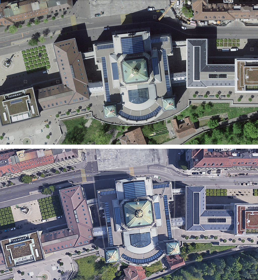
Sharper and more detailed than before, the new aerial photographsExternal link weren’t taken from satellites, as many others are, but from low-flying aircraft. The comparison with Google Maps is similar to that between analogue and HD television pictures.
swisstopo began using these high-resolution aerial photographs in 2017. Now the whole of Switzerland has been photographed for the first time.
“The new aerial photographs provide valuable information about the landscape,” says swisstopo spokeswoman Sandrine Klötzli. They are particularly important for experts – in spatial planning, archaeology, glacier development, agricultural and forestry use – but they are also of interest to the public, she says.
It should also be easier to recognise natural hazards. “In the event of a landslide, anomalies can be observed in the terrain,” Klötzli explains.
However, she points out that the images “are not the result of an immediate overflight. The data are generally from the previous year. But by comparing the aerial image data over time, the development of the terrain and possible shifts can be observed”.
She says this also benefits research, namely the Swiss Federal Institute for Forest, Snow and Landscape Research. The Federal Statistical Office also uses the images, and the cantons rely on the aerial photographs for numerous applications.
Easier route planning
“The tourism industry will certainly enjoy these high-quality images too and can use them to show detailed pictures,” Klötzli says.
In addition, many people are interested in seeing their house or neighbourhood from the sky, “or in exploring a well-known Swiss tourist destination more closely”. Particularly as this year many people are staying in Switzerland for their holidays because of Covid-19.
There’s also practical information for hikers. The latest version includes route closures and detours for non-motorised vehicles – if these last at least a week. The data are updated daily.
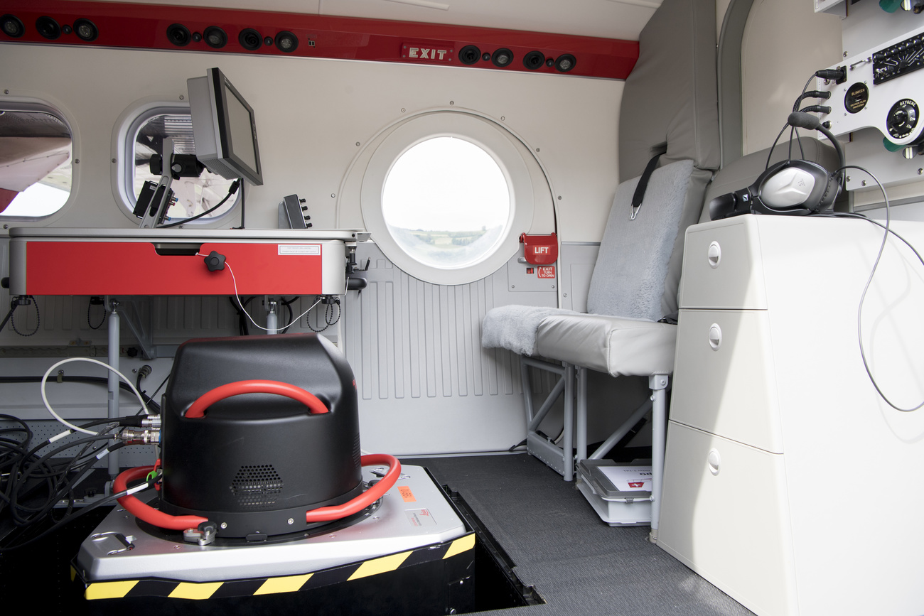
Aerial camera from space travel
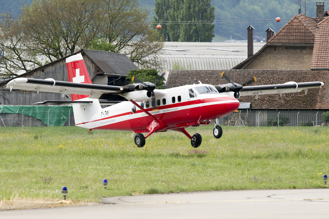
From 2017 to 2019 aircraft flew over a third of the country every year, according to a defined regional division based on cantonal boundaries.
“Thanks to this regional division, municipalities and cantons are always in possession of complete data from the same flight year for their entire sovereign territory,” says the swisstopo website.
The technology used for this purpose comes from space travel. “In this way, even road conditions, types of vegetation or details of buildings, such as roof windows or solar panels, can be identified,” it says.
The resolution is accurate to within ten centimetres in the more densely populated areas. For this, the planes had to fly over these regions at an altitude of about 2,400 metres.
In the mountainous regions, photographs were taken with 25cm ground resolution at an altitude of about 6,000 metres.
Ever-improving resolution
Aerial photographs of Switzerland have existed since the 1920s: first in black and white, then in colour, and finally with an ever-improving image resolution. Since 2005 the images have been digitally recorded. Since then, the resolution has been increased by a factor of 25, according to swisstopo.
The new cameras are able to capture a so-called image strip of up to 100 kilometres in length in a single image. An overlap of the image strips of at least 30% ensures optimal coverage of the photographed areas. In addition, each image strip is captured from three angles: vertically, forwards and backwards. This enables a 3D view of the area captured.
But what about spies? Can they enjoy the sharper aerial images as well?
“If the publication of the images hinders national security or the good functioning of the country, for example, access restrictions can be imposed,” Klötzli says.
Translated from German by Thomas Stephens

In compliance with the JTI standards
More: SWI swissinfo.ch certified by the Journalism Trust Initiative
Join the conversation!