Cold winter doesn’t buck global warming trend
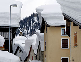
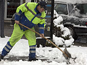
Temperatures sink to record lows while snow depths are twice the normal level - is Switzerland's seemingly abnormal winter another indicator of climate change?
Bern University climatologist Heinz Wanner tells swissinfo that although the current winter season may appear colder and snowier than usual the larger historical picture shows it isn’t as severe as it seems.
The head of the Climatology and Meteorology Research Group (Klimet), Wanner has for three decades been studying the climate to reconstruct conditions as they were up to 10,000 years ago. He’s also working to understand the influence humans have had on weather patterns.
Wanner explains that the deep cold and record snow has to do largely with changes in the air pressure thousands of kilometres away between the Azores and Iceland. Conditions there influence Europe’s wind patterns, which this year have sent storm after storm barrelling across Switzerland.
It’s a natural cycle, he says, but that doesn’t mean humans aren’t influencing those events.
swissinfo: Another storm just rolled through this week. With conditions like these some find it hard to believe that global warming is happening. Is it?
Heinz Wanner: First of all, it’s important if we really want to diagnose whether the influences are anthropogenic or natural, we need to look at data over a very long time and a very large area. Normally, if it’s warming in a certain area, it’s cooling at another site. The only answer, the important answer, can be given if we look at a global scale. On a regional scale or at a single site, there is much more natural variability.
swissinfo: So what is happening on a global scale versus a regional one here in Switzerland?
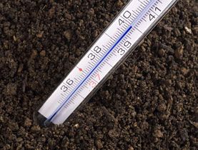
H.W.: The global trend for the last three decades has been temperatures increasing on average about 0.2 degrees per decade. In Switzerland it’s actually higher, at about 0.3 degrees.
swissinfo: But we seem to be having record cold with lots of snow.
H.W.: It’s a cold anomaly in southwest and central Europe. I can imagine that in certain sites in the Alps and in the plains, the length of the period of snow cover will be quite high and a record at some sites, but it’s local. It’s clear that almost every day you’ll have a record in some part of the world but we have to study it over a long time and on a global scale.
swissinfo: So why do we have so much snow then?
H.W.: A major mode of the climate system is the North Atlantic Oscillation. That’s an index that defines the westerly winds and whether they are strong or weak. It’s calculated by looking at air pressure between the Azores and Iceland. If it’s high or positive, the westerly winds are strong, and winds over the continent tend to be warm. If it’s low or negative, we have a more northerly flow with cold air, snow and cooler winters. This winter is a typical negative situation, which can even mean wind out of the east, which is extremely cold. That happened in 1956 and 1963 when the lakes froze in Switzerland and we could skate on them. But it’s a seesaw. While it’s cold here, northeast Europe is warm.
swissinfo: Has the seesaw always been this way?
H.W.: Looking back a few hundred years we can see we had this in the past. It was positive before 1950, then negative between the ’50s and early ’70s. It was clearly positive again in the late ’70s to late ’90s, and then negative again. The interesting thing is that we have started to study the processes behind the North Atlantic Oscillation – we don’t know the process in detail – but we can see it has a periodicity of about six to 15 years. If the system acts as it has for the past 200 years, I’m expecting a period of a few stronger winters again.
swissinfo: Does that mean we should go ahead and book our ski holiday chalet for next winter because it’s going to be good?
H.W.: No. The climate is quite sarcastic. We never have a clear situation. If we are talking about cooler winters in the next five to seven years, we have to expect single warm events in between. You can do weather forecasts for five to ten days but a climate forecast is a statistical one. You can’t do one for a single winter. What we are starting to do now are seasonal forecasts two or three months at a time, but that’s still very difficult.
swissinfo: These cycles between cold and wet and warm and dry sound natural then, that man isn’t responsible for these climate changes.
H.W.: There is a natural influence with strong natural variability. But if you want to explain climate change you have to study the energy balance of the earth. That’s the amount of energy coming to us through solar radiation, which is influenced by the orbital ellipse of the earth and other natural factors happening on the sun. But then we have human factors, too, like the greenhouse effect, land use and air pollution. The balance between these factors has to be studied and the only factor that is really increasing is the greenhouse effect. Therefore, there is a strong human influence.
swissinfo: Humans are incredibly adaptable. Is there not a way for us to just live with a warming climate?
H.W.: The only problem with global change is that we have enough money in these northern continents to adapt but what will people do in the not-so-developed areas like Africa? They don’t have enough water today and the available water will decrease. In policy, we really have to deal with this situation and help these other countries. If we don’t help with our technology and do not find the best solution we will see huge problems in the future.
swissinfo-interview: Tim Neville
Heinz Wanner, like many, remembers winters as a child being much colder and snowier than they are today. But is that scientific fact or the wistful yearnings of youth?
According to Christoph Marty, a researcher at the Institute for Snow and Avalanche Research in Davos, the answer is “a resounding yes” that Swiss winters were in fact snowier.
“Our analyses show that the trend towards less snowy winters for most stations below 1300m is statistically significant,” Marty wrote in a report published by the institute. “Especially on the Swiss plateau (about 400m above sea level), the last 20 years are regarded as those with the least snow since conventional measurements began about 130 years ago – and, according to historical records, the least for 300 years or more.”
Above 2000m, Marty says, there is no indication that climate change has reduced the amount of snow there. There is no question snow from middle to upper stations between 1,500m and 2,500m melts faster in the spring than it did 20 years ago. The reduced levels at lower elevations have more to do with warmer temperatures than the amount of precipitation, he added.
Between 1961 and 1990, data collected at seven low-altitude monitoring stations from Basel to Landquart showed that the absolute number of snow days – a day between December and March with at least 5cm of snow on the ground – declined dramatically in the late 1980s from 27 days to 13 days. In Zurich there have been more than 40 snow days so far this year, compared with two in December-March last year. In 1963 there were nearly 90.

In compliance with the JTI standards
More: SWI swissinfo.ch certified by the Journalism Trust Initiative

You can find an overview of ongoing debates with our journalists here . Please join us!
If you want to start a conversation about a topic raised in this article or want to report factual errors, email us at english@swissinfo.ch.