Exercising the brain and the body
For those who like to combine walking with learning, Switzerland has hundreds of discovery trails, covering practically every subject imaginable.
Trees and flowers, industrial history, agriculture, the structure of the solar system, local fairy stories – there’s something for everyone.
Some give a deeper understanding of the local region, some teach about a specific subject, while the main purpose of others is simply to enliven a family stroll.
swissinfo.ch went to investigate one of the newest additions, a geological trail around the Gastlosen mountains on the border of cantons Fribourg and Bern, whose purpose is very serious indeed.
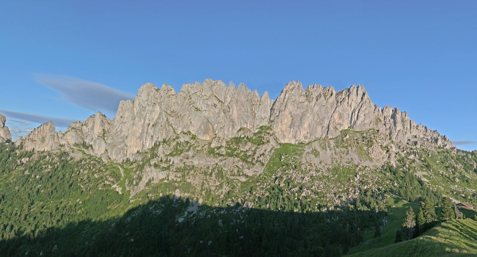
The Gastlosen resemble the sail on the back of a dinosaur: a 15-kilometre stretch of ragged peaks, which attract and fascinate walkers and climbers alike.
But they also figure on the list of geotopes of national importance, and the new path is designed to explain just why they are so interesting.
It is the fruit of collaboration between the geology institute at Fribourg University and the cantonal building insurance association (Ecab).
“At Ecab we support everything to do with educating people about geology,” Pierre Ecoffey, head of Ecab and himself a trained geologist, told swissinfo.ch.
“This path is very important for training future geologists. It’s not only the rocks that are explained, but also the problem of landslips. We insure buildings against landslips, so here we are interested in prevention.”
Long preparations, rapid construction
The idea was first proposed in 1995, but after some brief preparatory work it lay dormant for several years until Luc Braillard, a doctor of geology at the university, resurrected it, working mainly with one of his students, Daniel Rebetez.
Knowing that Ecab was willing to finance the project, he set up a small association to see it through.
Since first-year geology students are always taken to the area, he knew where the path should go in order to see the interesting rocks.
By a stroke of luck, Rebetez was able to complete his bachelor studies with the three months of his civilian service – the alternative to the military service which all Swiss men have to perform – and devote it to physically constructing the path.
A second man also doing his service came for about a month, but the only other major outside help was for a particularly difficult stretch which needed specialised equipment to stabilise the path.
This was provided, and paid for, by the canton, which sent two groups of 30 emergency rescue trainees for two days each. For them, it was a useful chance to put the skills they had learned into practice, so everyone benefited.
Members of the association came to give Rebetez a hand where and when they could. But their main contribution was in editing the brochure that explains the path. Sales of this should generate a modest profit which will go into the upkeep of the trail.
Insurance companies
While the Gastlosen geology trail would be unthinkable without the input of enthusiasts, the financial backing of Ecab was also vital. And it is by no means unusual for insurance companies to support the creation of discovery trails, as Vera Schädler of the Swiss Insurance Association told swissinfo.ch.
In the past nine years the association has helped establish nine trails all over Switzerland to teach visitors about the importance of protective forests in the mountains.
“Intact forests protect people living in the mountains from natural disasters like avalanches, rockfalls, landslides and floods. But most people hardly know anything about the important role they play,” Schädler explained.
“Private insurance companies want to make an active contribution to prevention work and making people aware of their responsibilities,” she said.
To get the message across, the paths are designed to be fun; the information is presented in such a way as to allow visitors to choose for themselves how deeply they want to go into the subject.
A bonus attraction
Although these paths are called discovery trails or learning trails, they overlap with others that are not quite so serious – like the “joke trails” in Appenzell and elsewhere, where jokes in the local dialect are displayed on boards along the path.
Switzerland Tourism, the umbrella organisation, categorises them as a “family” interest, rather than as something for serious hikers.
“On the whole they complement what is already on offer,” Rafael Enzler, head of marketing at Switzerland Tourism, told swissinfo.ch. There are very few which would attract people for their own sake.
Be that as it may, Jean-Marie Buchs, head of the tourism office in Jaun at the foot of the Gastlosen, is confident that visitors will like the new trail.
“This is an extra attraction we now have: people are really interested in this kind of subject,” he said.
Julia Slater at the Gastlosen, swissinfo.ch
Since there is no umbrella organisation for discovery trails, there is no comprehensive list available.
Some, like the geology or industrial history trails, are tied to the particular path where they have been established.
Others, like agricultural or natural history ones, are more general, but refer to their region.
Some, like planetary or “joke” trails, could be established anywhere.
The Swiss Academy of Sciences lists 172 geological trails on its website (see links).
Another popular subject is the solar system: scale models of the planets are arranged along a path, usually at a ratio of 1:1 billion.
There are trails in many forests, with information about the trees there.
One of the most unusual trails is the “Klangweg”, or “tone trail” in the Toggenburg in eastern Switzerland, where visitors can try out unique musical instruments built especially for the trail.
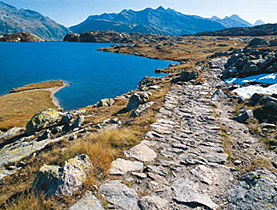
The path is about 5km long, plus another three to get back to the parking place at its starting point, the Gross Rüggli chalet.
It is possible to access it by public transport as far as the village of Jaun (Bellegarde in French); it then takes an hour or so to walk up to the Gross Rüggli.
The path starts at about 1350 m and its highest point is at about 1800m.
There are 12 stopping points, explained in the accompanying brochure or (in more detail) in the booklet.
The visible phenomena include:
The results of landslides
The “couches rouges”: a sedimentary deposit rich in hematite, responsible for its red colouring
Strata of radiolarites, formed on the African plate and carried northwards as the Alps formed. They were used to make arrowheads and other tools in the Middle Stone Age (9,500-5,000 B.C.)
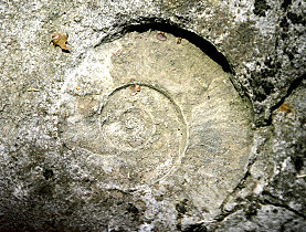
Fossil mussel colonies

In compliance with the JTI standards
More: SWI swissinfo.ch certified by the Journalism Trust Initiative
You can find an overview of ongoing debates with our journalists here . Please join us!
If you want to start a conversation about a topic raised in this article or want to report factual errors, email us at english@swissinfo.ch.