Swiss scientists put finishing touches to Envisat
Scientists in Switzerland are preparing to analyse data from an Earth observation satellite, which should provide early warning of natural disasters.
The team based at the University of Zurich is in the process of calibrating instruments for evaluating data from Europe’s most powerful and sophisticated satellite.
Urs Frei, Zurich University
I am convinced that it will be possible to estimate the probability of natural disasters.
The satellite is designed to help scientists better understand climatic shifts such as the speed at which ice caps are melting, the state of the El Nino current, and the depletion of the ozone layer.
From March – after the calibrations are completed – data sent back to Earth from the satellite will achieve unprecedented precision levels, according to Urs Frei, who heads the team of Swiss scientists at the Institute of Geography at the University of Zurich.
Data already sent back to Earth from Envisat, which was put into orbit in March last year, has left the Zurich team enthusiastic about the satellite’s potential.
“The various instruments on board Envisat have provided a wealth of data,” Frei told swissinfo.
Precision instrument
Envisat’s ten sensors can detect minute changes to the Earth’s surface, ocean-surface temperatures and the planet’s atmosphere.
“One of Envisat’s instruments measures sea-surface temperatures that can be used to monitor the directions of oceans currents, which provides a better understanding of weather patterns,” Frei told swissinfo.
Although the satellite – which circles the Earth every 100 minutes – is unlikely to be able to predict the exact time and location of natural disasters, the technology could be used to act as an early warning system.
“I am convinced that it will be possible to estimate the probability of natural disasters such as floods or landslides, and therefore countermeasures could be taken early to mitigate the effects of such events,” said Frei.
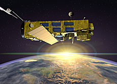
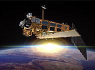
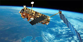
Satellite
Instruments aboard Envisat – which will remain in orbit for five years – are sensitive enough to detect subsidence in a city street of one millimetre a year, from a height of 800 kilometres above the Earth.
It takes Envisat three days to complete a map of Earth, which requires plenty of processing power on the ground.
The data sent each day from the satellite is sufficient to fill the hard disks of about 500 personal computers.
Scientists from 14 countries have cooperated on the €2.3 billion (SFr3.35 billion) project.
swissinfo, Jacob Greber and Karin Kamp
Envisat can complete a map of the Earth in three days.
Envisat instruments are sensitive enough to detect subsidence in a city street of one millimetre a year.
The satellite circles the Earth every 100 minutes.
Data sent from Envisat each day are enough to fill the hard disks of about 500 personal computers.

In compliance with the JTI standards
More: SWI swissinfo.ch certified by the Journalism Trust Initiative
You can find an overview of ongoing debates with our journalists here . Please join us!
If you want to start a conversation about a topic raised in this article or want to report factual errors, email us at english@swissinfo.ch.