


Many Swiss valleys face considerable landslide risk
Select your language
Generated with artificial intelligence.
Listening:
Many Swiss valleys face considerable landslide risk
In addition to the “best-monitored slope in Europe” above the landslide village of Brienz, there is a considerable risk of landslides in many other Swiss valleys, particularly in the eastern canton Graubünden. Every tenth building in the canton is located in a general natural hazard zone.
+Get the most important news from Switzerland in your inbox
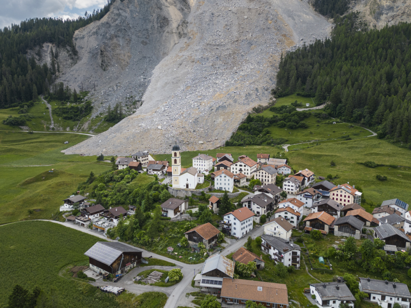
Probably the best-known case of high landslide risk is currently in Brienz in canton Bern. Around 80 residents of the village in the Albula Valley have been evacuated since November due to the threat of a rock avalanche. But that’s not all. The entire mountain above the village has been intensively monitored for years and, according to the responsible municipality of Albula, is the “best-monitored slope in Europe”.
Back in spring 2023, around 1.2 million cubic metres of debris came loose and stopped just short of the village. All residents were evacuated early back then too.
More
Thirty residents return home following Swiss landslide
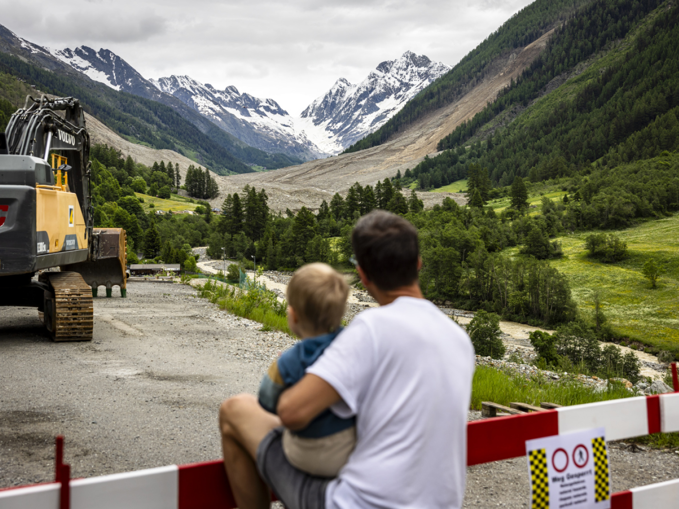
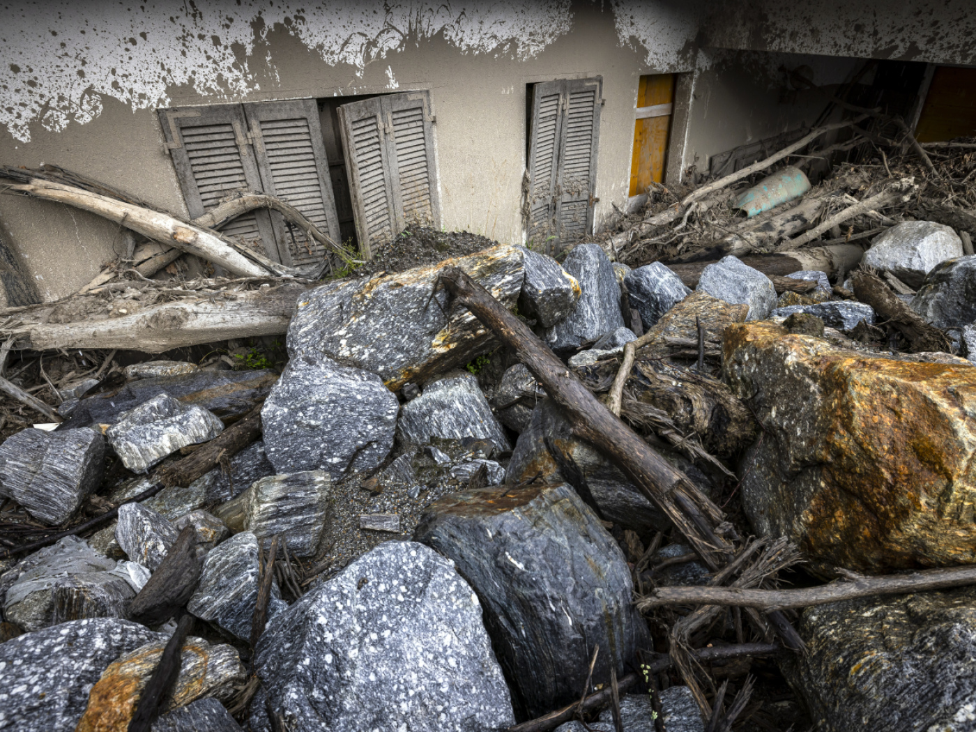
The example of the landslide in Bondo in Bregaglia shows that this is not always successful. The accident on Piz Cengalo claimed eight lives in 2017, when three million cubic metres of rock fell from its northern flank. Just a few weeks ago, three million cubic metres of rock and mud buried the village of Blatten in canton Valais.
Other areas with a significant risk of rockfall and landslides can be found between Thusis and Andeer, in the Rhine forest near Sufers and Splügen, near Savognin and Mulegns on the Julier Pass and in the Engadin near Pontresina and Samedan as well as in Susch, Lavin and Zernez. Rockfalls can also be expected in Poschiavo, Bregaglia and Misox, in canton Graubünden highlands, in Domleschg and near Chur in Felsberg. A look at the interactive hazard map of the canton of Graubünden shows this.
Over 5,000 homes at risk
Of a total of 170,000 buildings in the canton, 10% are located within general natural hazard zones, as can be seen from the cantonal guide to hazard maps. Of these buildings, one third are inhabited – that makes 5,100 residential buildings, another third of these 10% are used for agriculture, one fifth are industrial and commercial and the rest are used for other purposes.
In addition to rockfalls and landslides, Graubünden is also at risk from avalanches, debris flows, flooding, landslides, collapses and earthquakes. The latter harbours the greatest risk, said cantonal natural hazards specialist Urban Maissen to Südostschweiz newspaper at the end of May. An earthquake with a magnitude of 5.6 in the Chur area could claim countless lives and cause billions in damage, Maissen told the daily newspaper.
What is your opinion? Join the debate:
External Content
Translated from German by DeepL/jdp
We select the most relevant news for an international audience and use automatic translation tools to translate them into English. A journalist then reviews the translation for clarity and accuracy before publication.
Providing you with automatically translated news gives us the time to write more in-depth articles. The news stories we select have been written and carefully fact-checked by an external editorial team from news agencies such as Bloomberg or Keystone.
If you have any questions about how we work, write to us at english@swissinfo.ch


In compliance with the JTI standards
More: SWI swissinfo.ch certified by the Journalism Trust Initiative
You can find an overview of ongoing debates with our journalists here . Please join us!
If you want to start a conversation about a topic raised in this article or want to report factual errors, email us at english@swissinfo.ch.