


Using Swiss AI and drones to count African wildlife

After a promising first run in Namibia, a Swiss project could aid savanna conservation using drones and automatic image analysis.

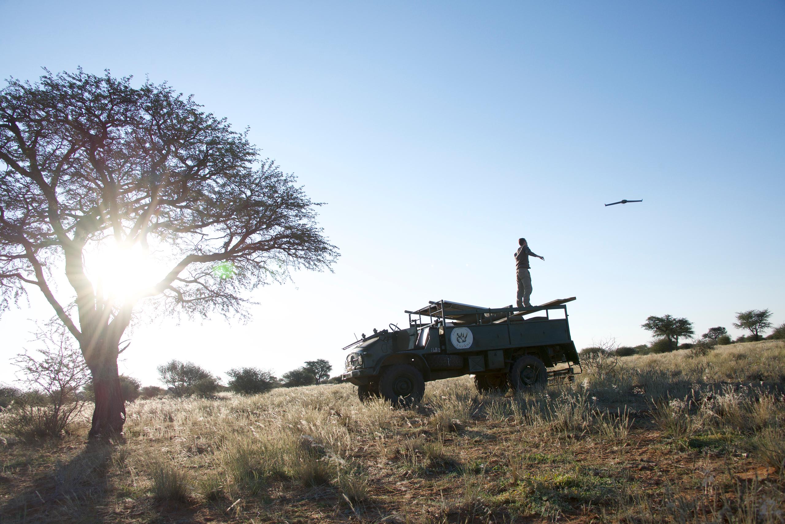
To get a sense of how many animals live in a given area, game counts are typically done in real time by sharp-eyed people in vehicles. The Savmap projectExternal link, started at Swiss federal technology institute EPFLExternal link and involving scientists in Switzerland, Namibia and the Netherlands, uses drones and artificial intelligence (AI) to count wild animals more efficiently.
“Human eyes are very good at detecting animals, but not at screening countless images. Computers can process a lot more data,” explains Swiss geo-information specialist Devis Tuia, who received a personal grant from Swiss National Science Foundation to form a lab to develop data science-based solutions for the use of remote sensing data in the environmental domain. This can be used to improve wildlife monitoring methods in places like Namibia, for example.
During the four-year project, which wrapped up last month, Tuia and his team built an AI system to study urban and natural environments, including extensive study on detecting animals photographed by cameras mounted on drones.
Rocks or oryx?
Savannah grasslands are too dry to sustain many trees, which makes them well-suited for drone exploration. Despite the annual wet season, overgrazing and unsustainable water usage can exacerbate droughts – causing wildlife to suffer.
The Kuzikus Wildlife ReserveExternal link in Namibia served as the test site for the Swiss project, and student researchers flew drones overhead to photograph the entire reserve in 2014 and 2015. The drones collected about 150 photos per square kilometre; the next step was sorting the images featuring animals like oryx, kudu and zebra.
“Crowdsourcing really allowed us to get started with the AI work,” says Tuia, explaining how the MicroMappersExternal link team at the Qatar Computing Research Institute provided a platform that allowed volunteers to look into the images and gather the data necessary to help the computers identify everything that looked like a large animal.
This initial phase of elimination and sorting was the longest and most painstaking. Now, with a high level of accuracy, an algorithm can flag images containing animals and discard those without.
“For the AI system to do this effectively, it can’t miss a single animal. So there has to be a fairly large tolerance, even if that means generating more false positives, such as bushes wrongly identified as animals, which then have to be manually eliminated,” he says.
“In the beginning we were rather sceptical,” says reserve director Friedrich Reinhard. “The drones produce so many images that I thought it would be difficult to use.” But in fact the system made it possible for a single person to do a full count of the reserve – which measures 100 square kilometres – within a week. Normally a team of people would have to do the job by helicopter, which is more expensive and less accurate.
“It’s simple for a ranger to go through the pre-selected images and say ‘yes’ or ‘no’. It’s easing their workload rather than eliminating their job,” says Tuia.
Fear of poachers
Initially, rangers were worried about sharing images of critically endangered black rhinos out of fear that poachers would try to find them. However, the researchers were able to persuade them that the animals would have moved on by the time the images were released.
“Knowing where the animals are and how they move helps you protect them,” Tuia says, pointing out that this knowledge of wildlife behaviour was helpful for conservation. “For example, the rangers were interested to see whether they had enough food for grazing so that they could provide supplementary food if not.” Being able to find the animals for safaris is another way of generating tourism income that can boost the local economy as well as conservation effiorts.
Using drones to do a wildlife census – or to detect poachers – also reduces the risk of a ranger being killed by illegal game hunters, who tend to be heavily armed.
Next steps
What needs tweaking is the AI system’s ability to work with images from different times of the day or year, taking into account longer shadows or thicker vegetation.
“The system is still at a prototype level. It would also need a user interface to get onto a ranger’s desktop. We’re eager to see how this could be adapted to other places, like Kenya,” says Tuia, noting that there’s interest in South Africa as well.
Now the Ol Pejeta ConservancyExternal link in Kenya is testing a similar system using alternating drones, one of which flies and takes photos while the other is re-charging.
Tuia, who still collaborates with his former colleagues at the University of Zurich and EPFL, is now a professor at the Laboratory of Geo-information Science and Remote Sensing at the University of WageningenExternal link in the Netherlands.
He’s currently working on various geodata projects to do with urban planning and land use, with a view towards shaping better cities and coping with deforestation and crop disease.

In compliance with the JTI standards
More: SWI swissinfo.ch certified by the Journalism Trust Initiative
You can find an overview of ongoing debates with our journalists here . Please join us!
If you want to start a conversation about a topic raised in this article or want to report factual errors, email us at english@swissinfo.ch.