


Switzerland plans to use satellite images to monitor ground motion

The Swiss government wants to detect previously unknown ground movements, particularly those related to thawing permafrost. To do this, it plans to use data from the European Space Agency's (ESA) Sentinel-1 satellite, according to the NZZ am Sonntag.
Select your language
Generated with artificial intelligence.
Listening:
Switzerland plans to use satellite images to monitor ground motion
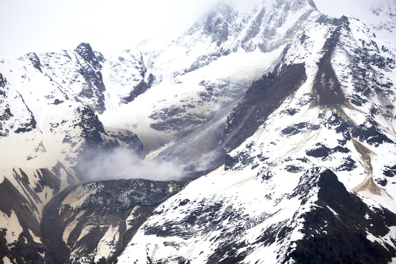
As landslides continue above the Valais village of Blatten, preventing residents from returning home, the Swiss government wants to monitor ground movements across the country to anticipate landslides, rockfalls and other subsidence, writes the NZZ am Sonntag.External link
+ Get the most important news from Switzerland in your inbox
To this end, it is planning a national monitoring system based on data from the European Space Agency’s (ESA) Sentinel-1 satellite, the Sunday newspaper reports, citing internal reports and documents. The satellite in question, orbiting at an altitude of 700 kilometers, continuously scans the Earth’s surface. It feeds into the European Copernicus program, which allows the European Union to monitor water, soil, air, and the atmosphere using accurate and regular data.
More
Why do Swiss mountains collapse? It’s complicated
“The goal is to identify instabilities that are not yet known,” the Federal Office for the Environment (FOEN) explained to the German-language newspaper. The monitoring should, in particular, make it possible to detect major movements due to the thawing of permafrost throughout Switzerland.
Spanish company commissioned
The FOEN has commissioned a specialist company in Barcelona to obtain and process its data. The first maps and analyses are expected by the end of 2025 – more than a year behind the original schedule. The FOEN has mentioned a change of supplier to better meet technical requirements, without providing further details.
Geographer Yves Bühler, an expert in alpine remote sensing at the Institute for Snow and Avalanche Research in Davos, hails the project as a valuable early warning tool. Cantons have also shown great interest. Other countries, such as Norway, are already using this type of monitoring nationwide, reports the NZZ am Sonntag.
But the project could be compromised even before its launch. For economic reasons, the Swiss government decided a year ago not to join—at least initially—the European Copernicus program, which would have cost around CHF45 million per year. This cost savings jeopardises long-term access to the strategic data needed for national surveillance.

In compliance with the JTI standards
More: SWI swissinfo.ch certified by the Journalism Trust Initiative
You can find an overview of ongoing debates with our journalists here . Please join us!
If you want to start a conversation about a topic raised in this article or want to report factual errors, email us at english@swissinfo.ch.