


The men behind the maps
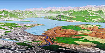
A glance at a map of Switzerland shows that it's rarely possible to get from A to B in a straight line. Switzerland's topography has made it into a nation of map-readers and turned Swiss mapmaking into an art.

Martin Gurtner revs up the engine and tries to take his jeep up a steep muddy track through a forest near Bern. He’s a topographer – one of the frontline warriors at the Federal Office of Topography. “It could mean walking 12 hours in the mountains where there aren’t any roads. It could mean 10 hours driving in the flatter areas, if it can be done with a car,” he says.
The office revises its maps every six years. There are 200 map sheets covering Switzerland and it takes one topographer a month to check just one sheet for possible alterations. “Sometimes you’ve got to drive backwards for a couple of kilometres on a mountain slope because there’s been a rock slide and there is nowhere to turn around,” says Gurtner.
“Many of our topographers can tell stories about dogs biting their tires; there’s always something happening. You’re out in the field, living with the elements; you’ve got to work in the rain and snow, which makes the work interesting, but also very hard.”
Gurtner is able to navigate the muddy track, which has obviously been widened since the previous survey, and decides to upgrade it from a “six” – classified as a hiking path – to a “five”, accessible to four-wheel drive vehicles.
Gurtner’s fieldwork is possibly the most glamorous aspect in the map-making process. Most of the work is done in the office’s labyrinth headquarters in Berne, where ancient and modern maps of Switzerland hang on the walls.
Under the control of the defence ministry, the work of the Federal Office for Topography is of national importance. But what sets it apart from most other countries is that Switzerland’s most detailed maps are readily available to the public. No self-respecting mountaineer, hiker or even Sunday cyclist would venture into the hills without one.
The only thing missing at the imposing headquarters is a map showing the way through its network of corridors, and a guide to the list of specialists who work there: topographers and cartographers, cadastral surveyors and experts in photogrammetry, satellite photography, Global Positioning Systems and geodesy.
Christof Käser is a photogrammetrist. It’s his department that sets the ball rolling for every map revision. “Each year, aerial photographs are taken of one-sixth of Switzerland,” he says. “We first have to set up a flight plan by giving the pilots the exact positions they have to fly through, and we give them the focal length that has to be used with their cameras.”
Each aerial photograph overlaps the previous one by 70 per cent, enabling the photogrammetrists to create a 3D image using an instrument called an analytical plotter. The photographs are fed into the machine allowing them to be compared with images from the previous revision.
“We can check to see if the differences are significant enough to update the map: new roads, new buildings, buildings which are no longer there, the change in vegetation,” Käser explains. “Everything that is visible in the photographs will be given a special code on the map.”
Red is used to mark new buildings, green changes to the vegetation. Blue crosses indicate the disappearance of trees or roads. The codes are then deciphered by a cartographer, who draws the new map.
“I work with this photogrammatric plot and a field map,” says Jürg Gilgen. “It’s the old map annotated by a topographer during his field survey. He had to check details which weren’t detected by aerial photography.”
“This footpath, for example, doesn’t exist anymore so we’ve had to delete it from the map. Perhaps it was no longer being used, so it wasn’t maintained. In winter, paths are often destroyed by snow or avalanches,” he says.
Even though maps are “drawn” on computers today, the cartographer is the artist of the process. Gilgen says the greatest challenge is what he calls “generalising” the map content to fit small scales.
“The smaller the scale, the less room I have to represent reality. I could scale all the information down from 1:25,000 to 1:100,000 but that would make it impossible to read,” he says. “Therefore, we have to generalise the content, emphasising important objects. Motorways, for example, have to be drawn much larger.”
But, he points out, smaller objects like buildings don’t just disappear. His skills come to the fore in maintaining the character of a group of buildings or other landmarks a hiker or cyclist might come across.
From Gilgen’s desk, the newly revised maps are sent to another part of the building to be reproduced, printed, folded and packed before being sent to retail outlets across the country.
Outside Bern, Martin Gurtner drives up to a low, square building on top of a hill dominated by a mast and antennae. This picks up the signals from the Global Positioning System satellites and broadcasts them across Switzerland.
The new technology has turned navigation into child’s play and provides all important reference points for mapmakers.
Back in his jeep, Gurtner follows a trail leading through another forest. He stops the vehicle, not quite sure if he can get through. He takes out his map and makes some notes. His kind is unlikely to be replaced by new technology anytime soon.
by Dale Bechtel

In compliance with the JTI standards
More: SWI swissinfo.ch certified by the Journalism Trust Initiative
You can find an overview of ongoing debates with our journalists here . Please join us!
If you want to start a conversation about a topic raised in this article or want to report factual errors, email us at english@swissinfo.ch.