
The globe, mapped by you
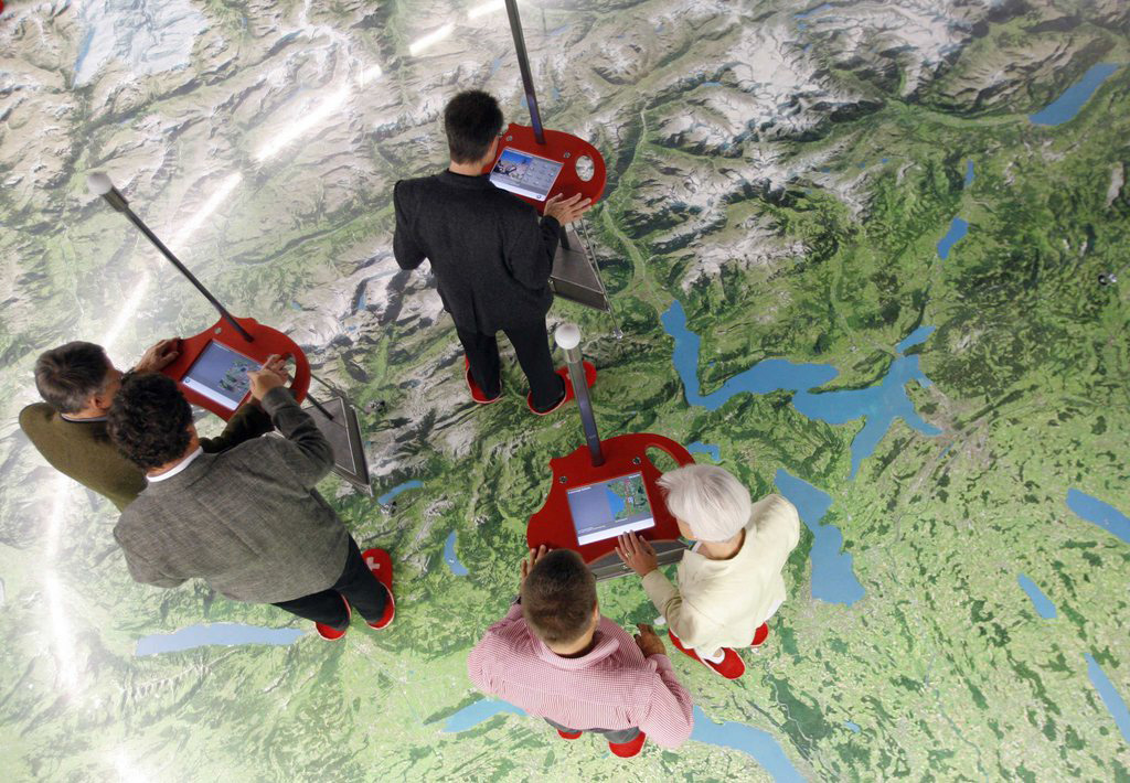
A map of the world, by the world, for the world – that’s what Swiss-based Openstreetmap chairman Simon Poole and a global network of more than a million map contributors are developing, rivalling mainstream mapping software in the process.
Poole tells swissinfo.ch that they mapped some areas long before Google but cannot compete with the company’s satellite imagery. Despite this, the project aims to make map data freely available for all.
Poole, who studied physics at the University of Zurich and has founded and sold several Swiss Internet start-up companies, took over the chairmanship of the Open Street Map Foundation in September 2012 when the founder Steve Coast moved to head mapping projects for Microsoft.
According to Poole, anyone can build on Openstreetmap data to map something very specific that fulfills a need for them. Then, users can view everything that’s ever been mapped on a specific point in Openstreetmap through an included feature called “explore map data”.
Some examples of unique things people have mapped include:
– “Robidog” stations, which in Switzerland provide dog walkers with baggies and a place to dispose of their animals’ waste
– Gas pipelines and power lines
– Cycling, hiking and sports trails, including a 400-kilometre-long inline skating path through Switzerland
– Ski pistes
swissinfo.ch: What is the purpose of Openstreetmap?
S.P.: When the project started out, there was this idea that we were going to map the world, and everybody thought that was impossible. I remember the first time I looked at the project about four years ago and I said, this isn’t going anywhere, this is nearly impossible. But when you look at what’s happened over the last couple years, I will say we are well on the way to providing map data to the whole world, and in the end we just want to have the data in there that people actually want to have.

More
New online tool enables `time travel’
swissinfo.ch: When Openstreetmap surpassed one million registered users, there was talk of the project rivalry to Google. What’s your take on that?
S.P.: That really depends on which region we’re talking about. In German-speaking Europe, we clearly rival any other provider with data density and with the currency of the data. That’s one of the strong points of Openstreetmap – we have these strong local communities, so if something changes – in Switzerland typically a new roundabout – they’ll be in the map on the day they open, if not before.
In the US we are not that strong, they are catching up a bit, and then in the rest of the world, it really depends. We are really strong in Russia, and in some of the developing countries, we are the only organisation that has reasonable maps. Google has been doing some catching up – for example, they announced a few weeks ago that they have maps in North Korea, something we have had for years (thanks to aerial imagery analysis and some defectors who contributed to the map). Google also announced they were mapping ski resorts and pistes – such data has been in Openstreetmap for a very long time.
Where we can’t compete with Google is in the breadth of their offering with satellite imagery, street view and similar products, but we consider that a bit out of scope right now and are concentrating on the actual map data, which is useful for other people to build competing products to Google.
swissinfo.ch: How do you guarantee the accuracy of a crowd-sourced map?
S.P.: Some people call it the 1,000-eye principle. We rely on the local community to quality control the data that is in the database, so in areas where we have strong communities like in Switzerland, errors will not go unnoticed and will be corrected short-term. In general, you will find that if there are substantial errors, they are corrected within a day or so. On top of that, we have quality assurance tools that look for things like road names, missing house numbers and roads that aren’t connected properly.
swissinfo.ch: Who are the contributors?
S.P.: I can only give my best guess. We do have a very, very long tail of infrequent contributors. These are people who will add the restaurant where they just had a meal or add their house number and that’s it. On the other hand, we have high-volume contributors who have made it into a serious hobby and spend hours per week surveying, importing data and in general improving the whole project. That could be software development as well, programmes we use to generate data, tools, all of that is open source and developed by contributors.
Some of the work going on now on the software side is to make it easier for these infrequent contributors to participate. If you use the programme once per year, you forget how it works and have to go through the learning curve again, so we’re trying to make that simpler. But in the end, something like 90 per cent of the data is really contributed by the core enthusiasts who tend to be young, white males, I have to say. That’s one of the issues we have: we’re trying to grow the contributor base not just in volume but in diversity, and that just takes time.
swissinfo.ch: Who uses Openstreetmap? Are many people using its technology regularly without knowing it?
S.P.: The applications that use the technology are not all branded under Openstreetmap, and this is where being a grassroots organisation tends to be difficult. We rely on the community to produce all this software so they will use their own names [when branding it]. There is not an Openstreetmap name that we stick on stuff, outside of our central website. There we control what is available and that is one of the official products that we have. But all the rest, the editors, the applications, are all third party.
In the media, it’s very popular to use our maps on websites because there is no license fee and you can control the map yourself. If we are lucky, there is an attribution on the map or something that points to us, but there are a lot of people who are using the data and nobody really knows.
But that’s the whole point of the project. We want to make map data freely available for everybody to use and to use as they like, and that’s a success. There are a lot of organisations switching to using Openstreetmap on the one hand because of costs and on the other because of the extra freedom they get from using our data.

In compliance with the JTI standards
More: SWI swissinfo.ch certified by the Journalism Trust Initiative







You can find an overview of ongoing debates with our journalists here . Please join us!
If you want to start a conversation about a topic raised in this article or want to report factual errors, email us at english@swissinfo.ch.